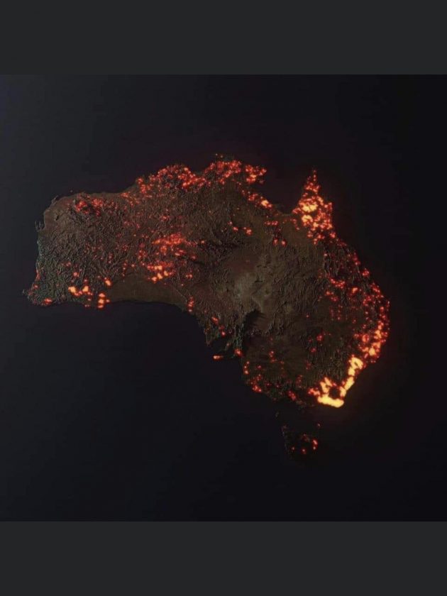
“3D “visualisation” of the fires in Australia, made from NASA satellite data. These are all the areas which have been affected, but not all the areas are still burning.”
Credit ~ Anthony Hearsey – Creative Imaging
reddit.com/r/MapPorn/comments/ekbtk0/3d_visualisation_of_the_fires_in_australia_made/