

This is based solely on what information is available. For example, a green border might be yellow or red in reality because of no news online or due to a recent unreported on
reddit.com/r/MapPorn/comments/d5ntbo/every_single_international_land_border_crossing/event . […]
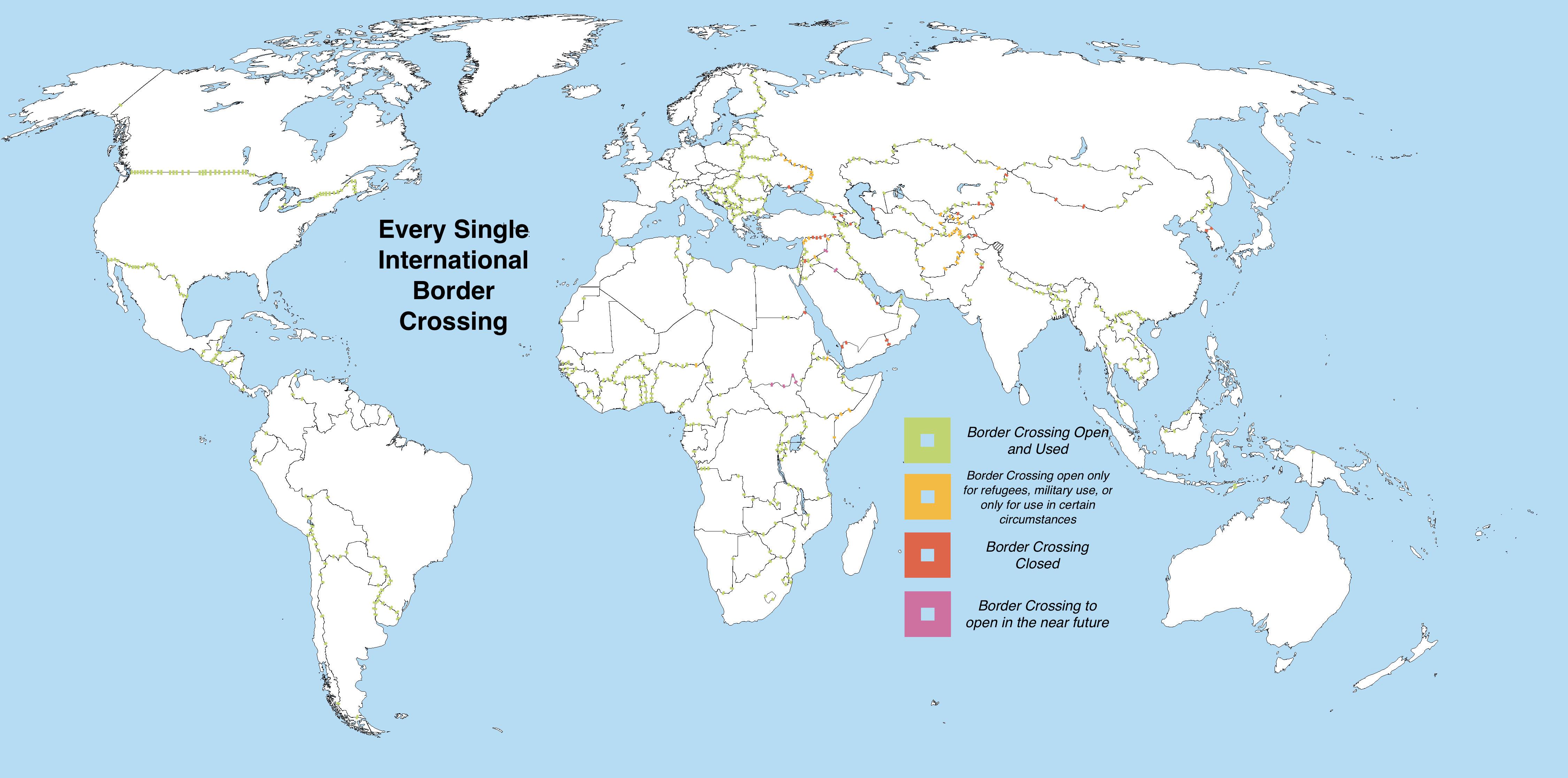
Wikipedia lists more borders than the map shows for some countries, but the borders it lists are often abandoned/nonexistent/tiny desert roads with no infrastructure. Every border shown has been verified by Satellite View on Google or Apple Maps.
Red Borders are not abandoned or destroyed border crossings, but borders that are closed due to an active decision by a Government, “enforced” closure.
Borders that enforce no controls at all are not shown, eg the Schengen area or the common travel area betweenUK and Ireland.
As many European border crossings are too numerous to add to the map, crossings shown are the main ones along motorways with themain infrastructure , tiny roads joining towns are not shown in Europe. Everywhere else on the map shows every legitimate International Land Border
I haven’t seen any map detailing the status of every international border crossing before, so I feel a tad proud to have made a map showing every single one in the world. Any feedback greatly appreciated
